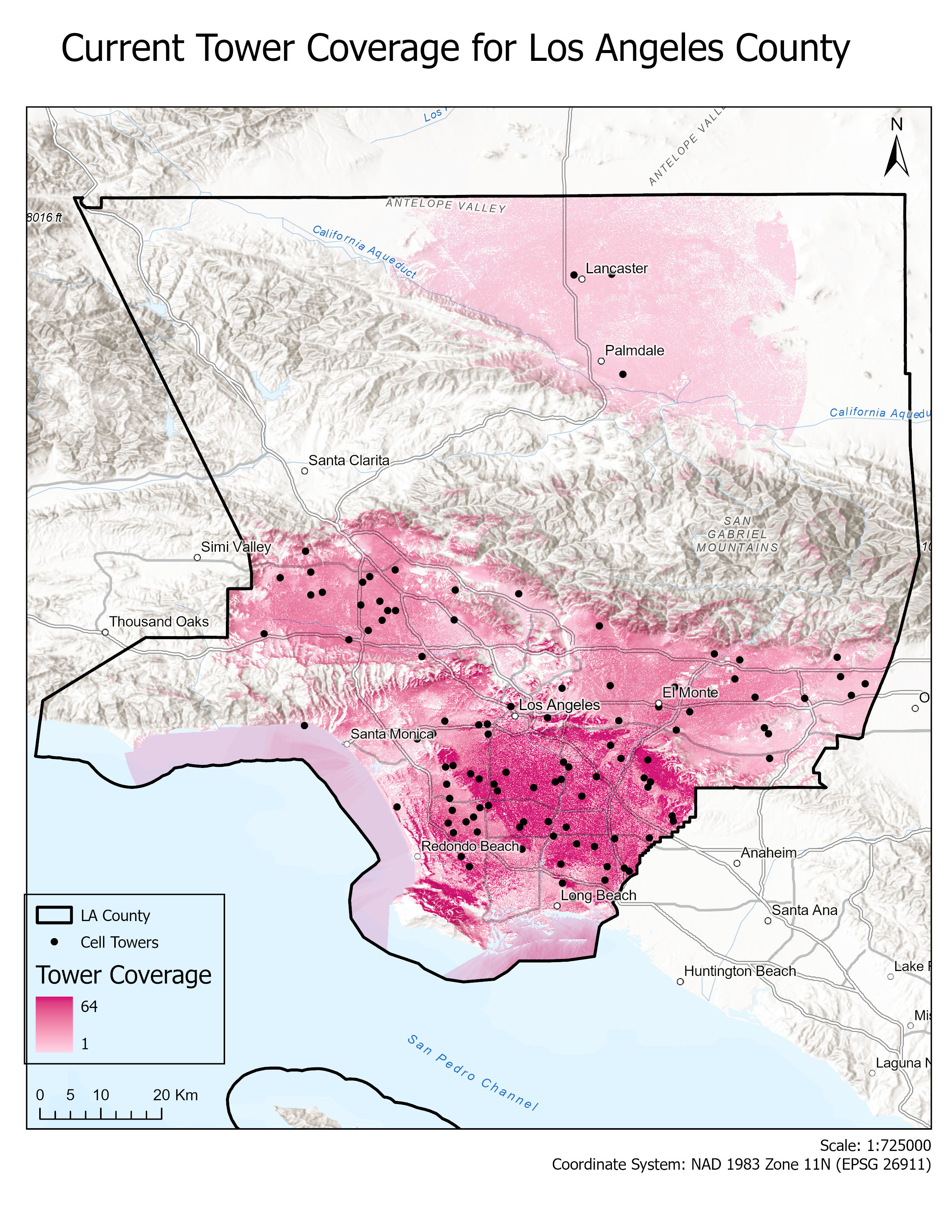
Coverage calculated using Geodesic Toolshed tool within ArcGIS, utilizing cellular tower data from the FCC. Calculations were performed accounting for elevation/surface offset, tower height, and average cell tower range. Areas that are darker pink are covered by a higher number of cell towers (with a max of 64 towers for one area), while areas that are lighter are covered by fewer. Certain areas like Santa Clarita and the mountains see no coverage at all.


Leave a Reply