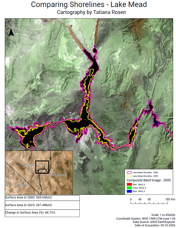
Created in ArcGIS Pro, this was created to compare the shoreline of Lake Mead in September 2000 versus in the same month in 2025. Raster imagery set to land/water false color imagery to highlight contrast between the water and land.
Shoreline polygons created by calculating the MNDWI value to isolate the lake from other materials.


Leave a Reply